At 21:48 on May 21, a 6.4 magnitude earthquake occurred in Yangbi County, Dali autonomous prefecture, Southwest China's Yunnan province (25.67 degrees north latitude, 99.87 degrees east longitude), at a depth of 8km (according to the China Earthquake Networks Center).Several aftershocks occurred after the main shock, threatening the lives and properties of people living in this area. After the earthquake, State Key Laboratory of Geohazard Prevention and Geoenvironment Protection (SKLGP) of our university responded quickly to collect remote sensing data and carried out preliminary analysis of geohazards and fault displacement in the afflicted area. At the same time, the laboratory sent professional staff to the scene immediately/as soon as possible to carry out field investigation and participate in rescue and relief work with their expertise.
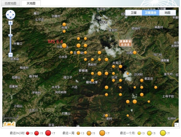
Figure 1. Epicenter and aftershocks distribution (from China Earthquake Networks Center)
【Quick response in organizing field investigation】
Organized a team in the first place to deploy and carry out emergency investigation on site. In order to grasp the disaster situation in time, especially the severity and danger of the secondary geological hazards induced bQy the earthquake, as well as to eliminate danger in time and ensure the relief work to go through smoothly. On May 22, the investigation team consisting of Associate Professor Li Tiantao, Mr. Wang Dan, Dr. Ju Yuanzhen and Dr. Tian Jingjing rushed to Yangbi County, the epicenter of the earthquake, and quickly carried out on-site related emergency investigation work. That night, the front-line researchers communicated with the relevant personnel of Yunnan Provincial Department of Natural Resources in Yangbi County on the basis of the preliminary survey results, which provided professional technical support for the rapid and orderly implementation of the earthquake relief work.
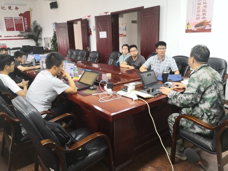
Figure 2. Communicate with on-site personnel from Department of Natural Resources Of Yunnan Province
Conducted scientific emergency investigation and released relevant findings in the first place, guaranteeing the relief work after the earthquake. In order to fully grasp the development and impact of secondary geohazards of the earthquake, front-line researchers carried out a comprehensive geological hazard survey in the earthquake-hit townships, promptly proposed emergency disposal measures, released relevant information, and assisted in the siting of emergency resettlement houses on site.
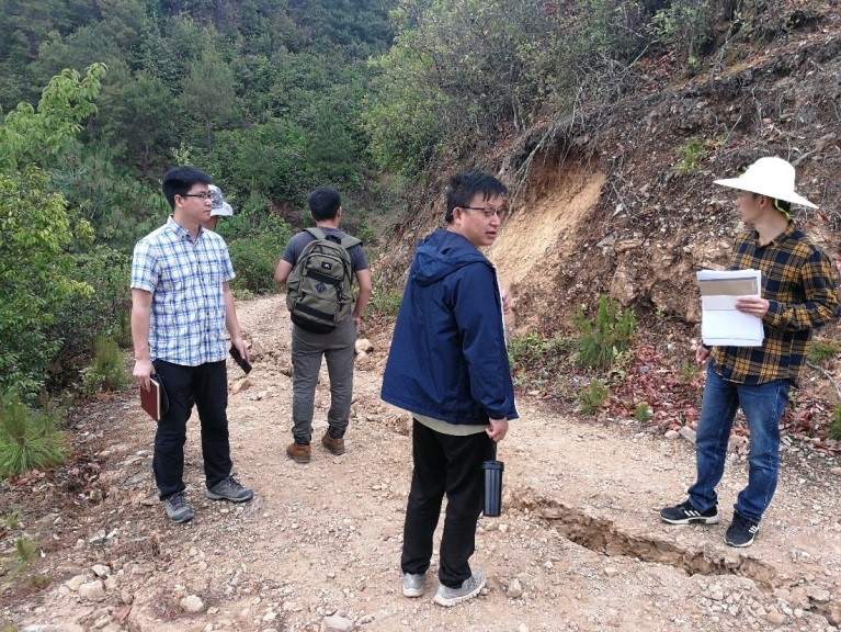
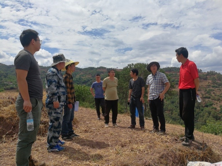
Figure 3, 4. On-site investigation
Summarized the characteristics of disaster developments in the first place to support post-earthquake screening of geological hazards. Based on several days of on-site investigation and remote sensing interpretation, the preliminary analysis of the investigation team concluded that the type of geohazards in Yangbi "5.21" earthquake was mainly small landslides, and no large collapses or landslides were seen, and the hazards were mainly concentrated in the Ⅷ degree intensity area. At the same time, the earthquake generated a large number of cracked hills, which may develop into landslides and collapses later. Long-term monitoring of cracked hills after the earthquake are needed, and it is recommended that long-term observation be carried out by means of on-site investigation, ground monitoring and InSAR for slopes with cracks and threatened objects in the lower part. The earthquake caused serious damage to a large number of local houses, most of which were adobe houses.
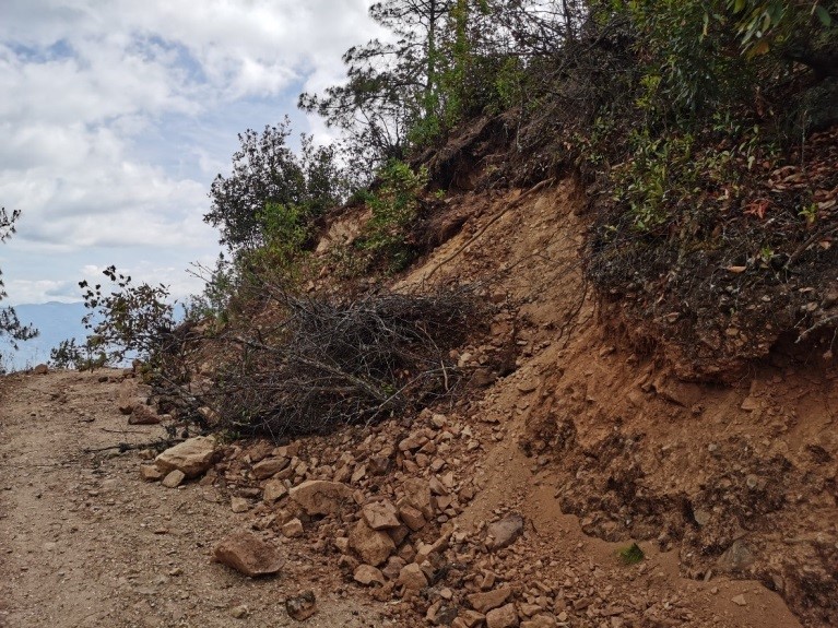
Figure 5. Small landslides triggered by earthquake
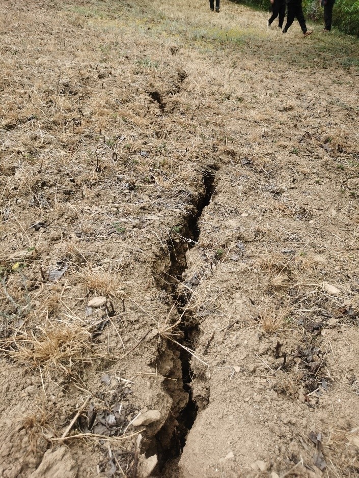
Figure 6. Earthquake cracks
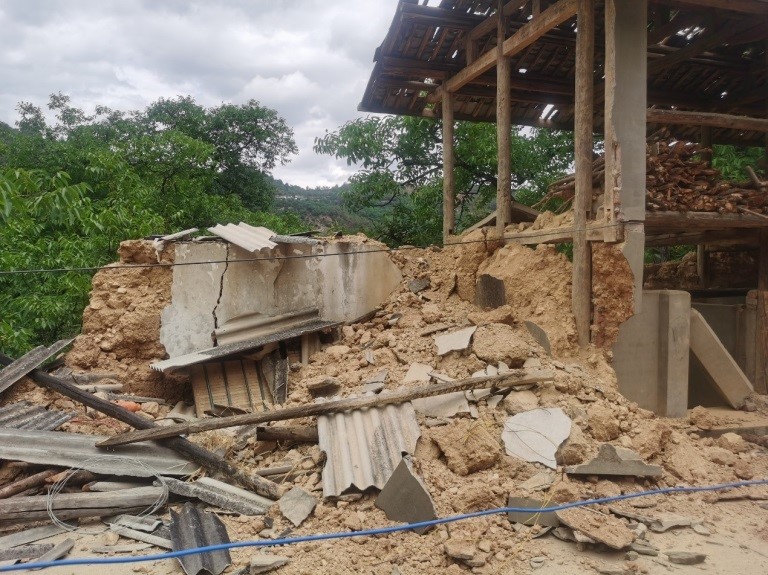
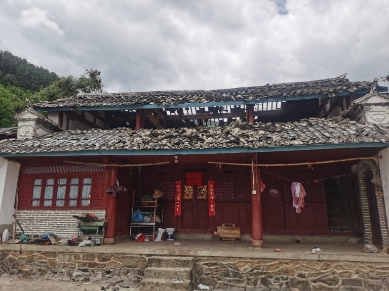
Figure 7, 8. Damaged houses after the earthquake
【Rapid Predictive Evaluation and Preliminary Remote Sensing Analysis】
After the Yangbi earthquake, the research team of the SKLGP conducted a preliminary analysis and investigation on the geohazard susceptibility, co-seismic surface deformation and fault rupture model of this earthquake.
(1)A Rapid Evaluation of Coseismic Geohazard Susceptibility
The SKLGP quickly collected information on the basic topography and geology and seismic parameters of the affected area. Based on the topography, geological conditions and seismic parameters, the research team has utilized the evaluation model of coseismic geohazard susceptibility of the 2014 Ludian Earthquake and chosen a variety of evaluation factors including peak acceleration of earthquake(from USGS), distance from faults, topographic slope, relative height difference, stratigraphic lithology and distance from water systems to evaluate the spatial occurrence probability of the induced geohazards by Yangbi Earthquake(Figure 9).
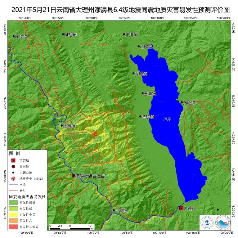
Figure 9. Evaluation of co-seismic susceptibility of MS6.4 earthquake in Yangbi County, Dali Prefecture, Yunnan Province on May 21, 2021
Evaluation results suggest that the most vulnerable areas in the Yangbi Earthquake are scattered on both sides of the sector from Maidi Town to Yangbi County, the less vulnerable area is mainly distributed in the epicenter—Cangshan Mountain, and others are the least vulnerable areas. It is suggested that field investigators focus on the above medium-prone areas to carry out post-earthquake geohazard investigation work.
(2) Preliminary remote sensing analysis of geohazards of co-seismic earthquake.
The laboratory research team collected satellite images taken before and after the earthquake, and conducted a rapid analysis of remote sensing data for coseismic geohazards. Due to the cloudy weather in the post-earthquake area, only some satellite images such as Planet have been collected in the epicenter area so far. Through comparative analysis of satellite images before and after the earthquake, only a small number of existing collapse and landslide hazards have been detected with signs of widening in the current post-earthquake areas covered by images and no new landslides have been detected. It is presumed that there should be few geohazards of collapse and landslide with small scale in the co-seismic earthquake, probably mainly small-scale landslides and rockslides.
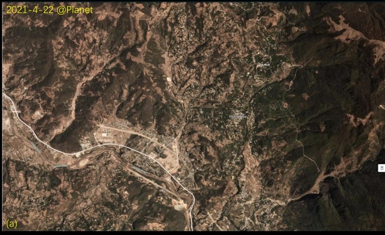
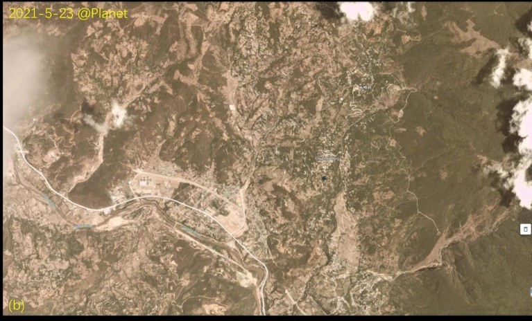
Figure 10. Planet satellite images before and after the earthquake in the area near Yangbi County (3.0m, provided by Earth Star)
(3) InSAR deformation monitoring and fault rupture inversion of the Yangbi earthquake
The laboratory research team quickly tracked several radar satellites at home and abroad and applied for the data first after ESA published the post-earthquake radar observation images of the Yangbi earthquake area by the Sentinel-1 radar satellite on May 22. Combined with the pre-earthquake radar images, differential interference was carried out to obtain the co-seismic InSAR surface deformation field of the Yangbi earthquake (Figure 11).
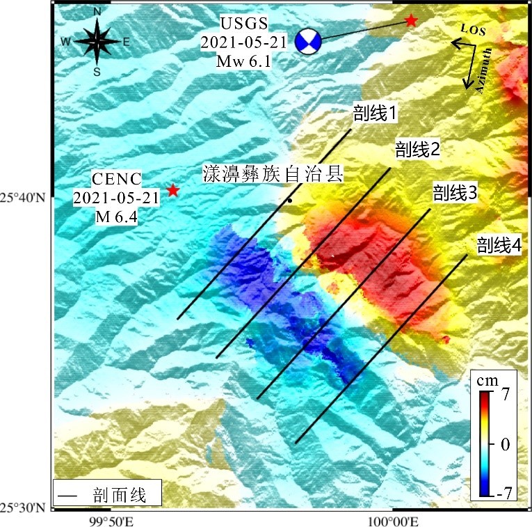
Figure 11. The InSAR deformation field of the Yangbi earthquake Sentinel-1 descending track, and the deformation profiles of the black solid lines 1-4 are shown in Figure 12.
The InSAR data shows that the Yangbi earthquake caused significant surface displacement in the near field of the fault, especially in the areas along both sides of the fault trace with large deformation gradients, resulting in InSAR interference de-correlation.
Combined with the deformation profile analysis in Figure 12, it can be found that the hanging wall on the southwest side of the fault has a negative deformation, showing a movement away from the satellite line of sight with a maximum deformation magnitude of about -6.7 cm, while the footwall on the northeast side shows a positive movement close to the satellite line of sight with a maximum deformation magnitude of about 6.9 cm. Further analysis of the deformation field shows significant inverse movement of the hanging wall and footwall. And combined with the focal mechanism solution of the strike-slip fault published by USGS, it can be inferred that the movement mechanism of the seismogenic fault is dominated by the dextral strike-slip movement.
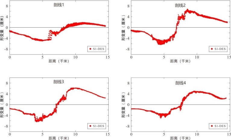
Figure 12. InSAR deformation profile, refer to Figure 13 for the position of the profile
Using the InSAR interferometric deformation field, the research team constructed a preliminary fault model, in which the fault is 22 km long and 13 km wide. Based on the elastic dislocations in a layered half-space theory the fault slip model of this earthquake was obtained by inversion, combined with nonlinear simulated annealing algorithm (Figure 13a). It can be seen that the fault strike angle is 135.3° and dip angle is 81.9°. The fault rupture is mainly the dextral strike-slip movement with some normal fault components, and the maximum fault misalignment is ~0.4 m, which is located at a depth of 4.0-6.0 km below ground. The magnitude of this earthquake is calculated as Mw 6.0 based on the model. The slip distribution shows that the main fault misalignment is distributed at 3.0-8.0 km depth.
Based on the fault slip model obtained from the inversion, the team forward-calculated the theoretical surface deformation field along the satellite line of sight in the main earthquake area (Figure 13c). Comparing the forward and observed InSAR deformation fields (Fig. 13b), the two have high consistency in deformation distribution patterns and magnitudes, and the absolute average residual between observed and forward data is ∼1.0 cm. Moreover, from the residual distribution (Fig. 13d), no obvious residual signal is found in the seismic zone except near the fault rupture trajectory line, which indicates the reliability of the inversion fault movement model.
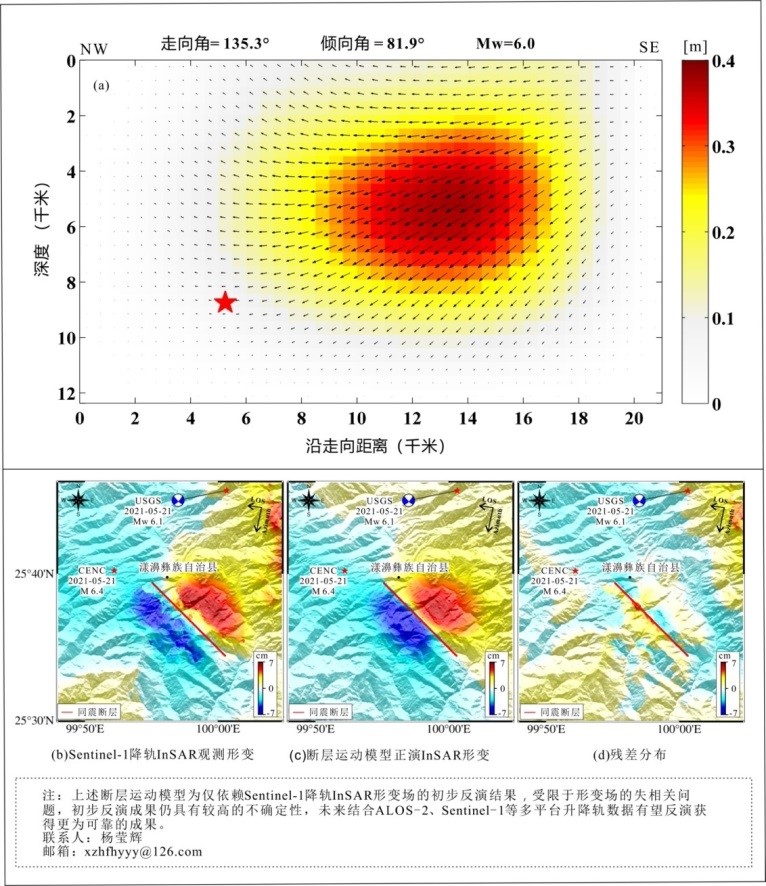
Figure 13 (a) InSAR deformation-based inversion and slip model of the Yangbi earthquake fault (b) Observations on InSAR deformation of Sentinel-1 descending orbit (c) Fault forward model of InSAR deformation field (d) Distribution of deformation residuals and the solid red line represents the inferred surface trajectory of the isoseismic fault.
Natural disasters are sudden and unexpected, but the hearts of people are full of strength. The SKLGP has always focused on geohazard prevention and control and geoenvironment protection, contributing professional strength to the cause of disaster prevention and mitigation, safeguarding economic activities and social security in China.