From 14:00, June 23 to 7:00,June 24,there has been many continuous heavy rains in Qinglong County, Guizhou Province and other places, among which, the rainfall in An'gu Township was up to 208mm, a heavy rainstorm level. At 12:57 p.m. on June 24, our real-time geohazard monitoring and early warning system in Guizhou province caught a big data change sent back by monitoring equipment such as GNSS set at Dazhai, Tuanpo Group, Qianjin village, An’gu Township. After automatic analysis, the system issued orange early warning. After receiving the warning message, the emergency duty personnel of Southwest Guizhou Natural Resources Bureau immediately contacted with the person in charge of An’gu Land and Resources Office, who immediately organize personnel to conduct on-site verification. Then, Southwest Guizhou Natural Resources Bureau requested the County Bureau of Natural Resources to start disaster prevention and emergency evacuation. At 13:24p.m., local instability occurred in Dazhai landslide, with a sliding volume of about 5,000 square meters, which blocked the village road. At 15: 57p.m., the on-site personnel received the red warning signal automatically sent by the monitoring and early warning system. The slope became unstable in a larger range, with an unstable volume of about 40,000 square meters. The monitoring and early warning system still monitors the stability of the residue.
After receiving the orange warning message from the automatic monitoring system, the local natural resources bureau took actions immediately and organized the evacuation of 8 households with 38 people. Due to the timely avoidance, no casualties and property losses were caused.
According to the investigation of experts from No.117 geological team, the main reason for the landslide is the continuous heavy rainfall in recent days, especially the rainstorm on June 23, which leads to the water saturation of the rock and soil mass. In addition, the steep terrain and loose landslide mass also contributed to the occurrence of the landslide.
In addition, on June 14, our province’s monitoring and early warning system issued a yellow warning signal(GP02) for the collapse of Huangnibao, Qianjin Group, Lianghekou Village, Shijing Township, Fenggang County, Zunyi City,Guizhou Province. After on-site verification: the deformed landslide was a small shallow surface soil landslide with an inclined length of about 40m, a transverse width of about 30m, a thickness of about 2-3m and a volume of about 2,000 square meters. The deformation was obvious. At present, the local concerned department was adopting interception and drainage measures, and the stability of this point was good.
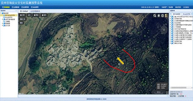
Figure 1: Real time geohazard monitoring and early warning system in Guizhou Province
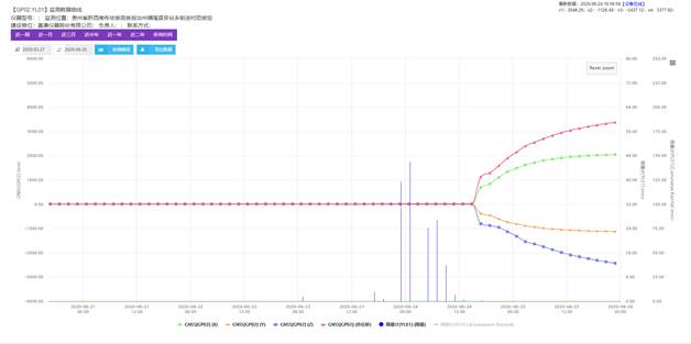
Figure 2: Displacement--rainfall monitoring curve
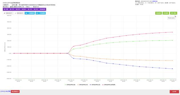
Figure 3: GNSS monitoring curve on the day of landslide
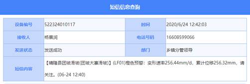
Figure 4: Warning message
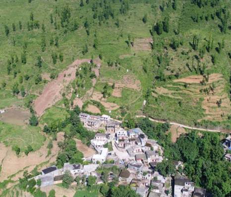
Picture 1: Aerial photo of the landslide
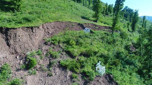
Picture 2: Serious cracking and falling of the back edge of Dazhai landslide
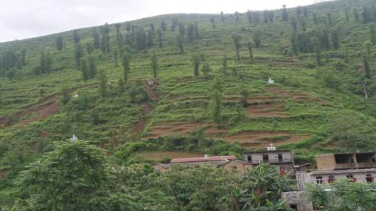
Picture 3: Landslide overlooking
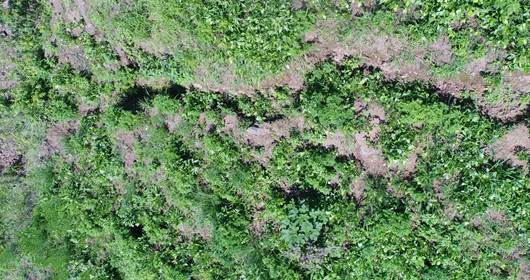
Picture 4: Cracks on the back edge of Dazhai landslide
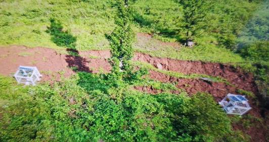
Picture 5: The back edge of the landslide is seriously pulled and cracked